Kap Verde 2019
Die Textpassagen wurden teilweise aus frei zugänglichen Seiten aus dem Internet entnommen.
Revier
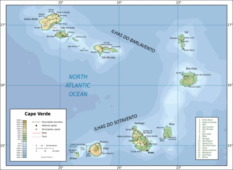
Kap Verde [ˌkapˈvɛrdə], amtlich Cabo Verde, portugiesisch Cabo Verde [ˌkabuˈveɾdɨ]) ist ein afrikanischer Inselstaat, bestehend aus den Kapverdischen Inseln mit neun bewohnten Inseln im Zentralatlantik, 570 Kilometer vor der Westküste des afrikanischen Kontinents. Der Archipel hat eine Landfläche von 4033 km² und etwa 546.000 Einwohner. Die Hauptstadt ist Praia.
Fauna und Flora
Die Vegetation der Kapverdischen Inseln ist aufgrund der Trockenheit halbwüstenähnlich. Es gibt unter anderem trockene Grasfluren, im östlichen Teil sind die Inseln auch mit großen Dünen oder Salzsümpfen (Mangroven) bedeckt. Dazu kommen einige Palmenarten wie die Kanarische Dattelpalme, die an die Trockenheit angepasst sind.
Die Tierwelt auf den Inseln ist vergleichsweise artenarm. Vor der Besiedlung durch den Menschen waren bis auf eine Fledermausart keine Säugetiere auf den Inseln vorhanden. Zudem gibt es einige kleine Reptilienarten, zum Beispiel Geckos und Skinke. An den Stränden legen Meeresschildkröten gelegentlich ihre Eier ab.
Geologie
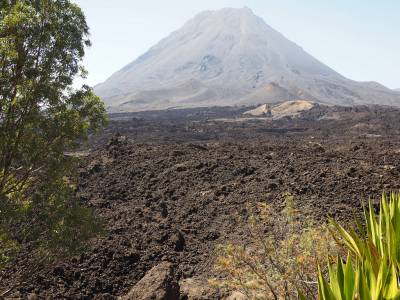
Der Archipel der Kapverden ist vulkanischen Ursprungs. Die höchste Erhebung der Kapverden ist der ebenmäßige Vulkankegel des Pico do Fogo mit 2829 Metern Höhe. 1995 brach er nach einer 44-jährigen Ruhephase wieder aus. Hierbei entstand der 1920 m hohe Parasitärkrater „Pequeno Fogo“, an dessen Rändern noch heiße Fumarolen tätig sind. Dieser Parasitärvulkan war ab dem 23. November 2014 wieder aktiv und spie Aschewolken und Feuer. Durch die austretende Lava, die sich in die Caldeira mit drei Hauptströmen ergoss, wurden zwei Ortschaften und einige weitere, kleine Ansiedlungen in der Caldeira zerstört. Die vulkanischen Aktivitäten endeten am 8. Februar 2015. Die Inseln im Nordwesten Santo Antão, São Vicente und São Nicolau sowie Santiago sind ebenfalls jung-vulkanisch und hochgebirgig, während die östlichen Inseln weitaus älter, bis auf einige Zeugenberge flach abgetragen und mit einem Kalksockel ausgestattet sind. Zum Archipel gehören auch noch folgende Tiefseeberge (englisch Seamounts): Seamount Nola (westlich Santo Antãos), Seamount Boavista (östlich Boa Vistas), Seamount Cape Verde (südöstlich Boa Vistas), Seamount Maio (östlich Maios) und Seamount Cadamosto (südlich Bravas). Möglicherweise gehört auch das Riff João Valente südlich von Boa Vista zu den Seamounts. Auf den Inseln gibt es bis auf die Ribeira de Torre und die Ribeira de Paúl (beide auf der Insel Santo Antão) keine permanent wasserführenden Flüsse oder Bäche. Im Inselinneren Boavistas besteht ganzjährig der kleine Süßwassersee Odjo d’Água. In der Regenzeit schwellen die ansonsten trockenen Täler der Ribeiras (= Bäche) oft zu reißenden Strömen an und zerstören Straßen und Wege, die dann mitunter längere Zeit unpassierbar bleiben.
Klima
Auf den Kapverdischen Inseln herrscht ähnlich wie auf den Kanarischen Inseln ein mildes ozeanisches Klima. Es ist aber wärmer und trockener und wird vom Nordostpassat bestimmt. Das Klima ist durch geringe Temperaturunterschiede zwischen Tag und Nacht (meist um 5 °C) und durch ganzjährig relativ hohe Luftfeuchtigkeit (um 70 %) gekennzeichnet. So liegen die Tagestemperaturen das ganze Jahr zwischen 23 und 30 °C, wobei die Nachtwerte im Winter (Januar bis April) um 18 und im Sommer (August bis Oktober) um 24 °C liegen. Der Boden ist überall sehr trocken, die durchschnittliche Niederschlagsmenge in der Hauptstadt liegt bei etwa 250 mm jährlich, sonst meist nur zwischen 100 und 200 mm. Der meiste Niederschlag fällt von August bis November. Die Wassertemperaturen mit 22 bis 27 °C machen das Land für den Strandtourismus attraktiv.
Überblick Kapverdische Inseln
Termin
2019-06-01 bis 2019-06-15
Sprachen
Portuguiesisch und Kreolisch - Sprachkurse zum Download (für den persönlichen Gebrauch)
Crew
An & Abreise
Reisedaten kompakt
Flugcodes und Hotelvouchers
Reisebestätigung/Rechnung
Wichtig: Reisepass prüfen: muss ab Einreise (1.6.2019) noch 6 Monate gültig sein
Visum: laut kürzlicher Mitteilung nicht mehr erforderlich für EU-Bürger bei Aufenthalt bis zu 30 Tagen. Man muss sich aber online registrieren.
Links:
Konsulat KapVerden in Österreich
Konsulat KapVerden in Deutschland
Registrierung KapVerden
Charter
Chartervertrag
Bestellte Extras - WIFI, 220V Konverter
Bordpass
Unterlagen Schiffsübernahme
Flughafen-Transfer-Voucher
Begleitbrief zu Bordpass
Infos zum Stützpunkt Mindelo
Marina
Marina Mindelo (Sao Vicente)
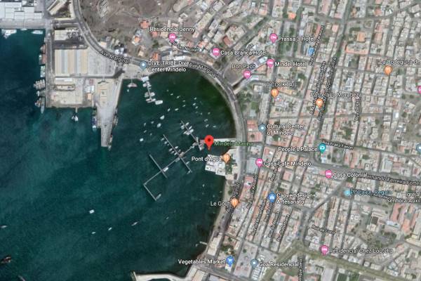

Services for Marina Mindelo clients:
- 720 meter pier (pontoons)
- 144 berths
- Up to 50 meter boat length
- 24 hour service and security
- 220 V at 16, 32 and 63 Amp on the pontoons
- Water supply to the columns
- Diesel Station
- Internet: Wireless
- Modern showers and toilets
- Floating Bistro / Sailor's Bar
- Weather forecast
- Coordination and links to external companies
- Contracting repair and supply works and purchases for yachts
- Support for local administrative services (imigration, Police, Customs)
- On request: Storage of small yacht Accessories
Contact: mmservice@marinamindelo.cv
Web: www.marinamindelo.cv
The diesel station open from Monday – Sunday
Monday to Friday from 08H00 to 18H00
Saturday & Sunday – 09h-12h / 15h-18h
Schiff
Jeanneau Sun Odyssey 44i „Bella Mia“
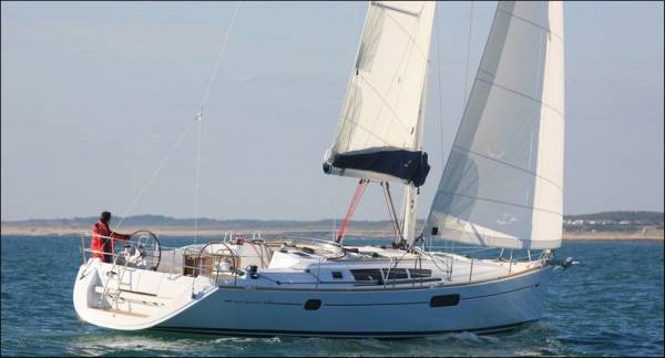
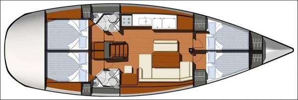
Daten
Length overall: 13.75 m
Beam: 4.37 m
Draft: 2.05 m
Passenges (max): 10
Berths: 10
Cabins: 4
Bathrooms: 2
Engine: 75 hp
Sails
furling genoa
furling main sail
bimini top
Yacht equipment
autopilot
electric anchor windlass
Fuel tank 240 l
water tank 615 l
Navigation
chartplotter
chartplotter in the cockpit
Safety
VHF
Additional equipment
12V plug at charttable
bathing platform
cockpit speakers
dinghy
gas stove with oven
sprayhood
warm water
Other
linen, pillows and blankets
outboard engine
Sicherheit
An Bord wird sein:
- EPIRB (Satelliten - Notrufgerät)
Ich nehme mit
- Strobe-Licht für Schlauchboot - falls jemand damit abends abtreibt und bei Dunkelheit gefunden werden muss
- 2 Marine - Handfunkgeräte zur Kommunikation zwischen Schlauchbootcrew und Schiff
- Garmin InReach Explorer Plus - SatellitenTracker (Iridium), Notruf- und SMS-Gerät
Live-Tracking unserer Position
Passwort: wobistdu
Wie bei der Vorbesprechung erwähnt:
die Schwimmwesten an Bord sind Feststoffwesten, keine Automatikwesten
Wer eine private Automatikweste hat und diese mitnehmen will - das ist immer eine gute Idee
Wir werden uns so verhalten, dass auch mit dem vorhandenen Rettungswesten-Material die Sicherheit maximiert wird
Die folgenden Unterlagen sind allgemeiner Art, nicht unbedingt auf diesen Törn anwendbar:
Sicherheitseinweisung
Hilfe auf See
Lloyd's Standard Form of Salvage Agreement
Medizinische Ausrüstung
Safety Equipment
Abrechnung
Verpflegung
Impfungen/Reiseapotheke/Notfallformular
Wir segeln in den Tropen, d.h. bitte beachtet Folgendes:
das bedeutet eine erhöhte körperliche Belastung
und ein erhöhtes Infektionsrisiko
bei schlechterer medizinischer Versorgung
Ein vorheriger Besuch beim Arzt wird angeraten
Bitte meldet mir im eigenen Interesse alle medizinischen Risiken, wie Herzschwäche, Diabetes, etc.
Ich war im Februar beim Arzt, hier sind Infos dazu:
Impfungen/Reiseapotheke
Folgendes Formular hilft uns im Notfall: bitte ausfüllen und mir in verschlossenem Kuvert mit Namen übergeben:
(ihr könnt es mir auch mailen und es wird vertraulich behandelt und nach dem Törn gelöscht)
Notfallformular
Ausrüstung
Besprechungen
Crewtreffen am Donnerstag 4. April 2019 ab 18:30
Griechisches Restaurant
„Art Corner“ http://www.art-corner.at
Prinz Eugenstrasse 56
A-1040 WIEN
Agenda:
- Überprüfung der Crewliste (Alle)
- Anreise, Rückreise, Formalitäten (Gernot)
- Revier+Wetter: Geographie, was ist zu erwarten (Erich)
- Unser Schiff: Törnablauf, Kojeneinteilung, Sicherheit (Gernot)
- Mögliche Routen, Landausflüge (Gernot)
- Ausrüstung, Bekleidung, Gesundheit (Gernot)
- Proviant (Alle)
- Finanzielles, Währung, Kreditkarten, Bordkassa (Erich)
- Sonstiges: Versicherungen, Telefon, Internet (Gernot)
Hafenbeschreibungen (2017/18)
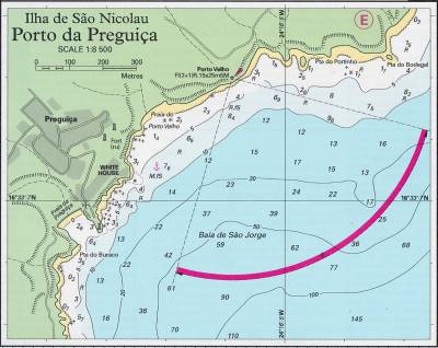
Tarrafal (Sao Nicolau)
Location
This mountainous island lies about 70nm due west of Sal. The peaks here cause sufficient rainfall to support the growing of fruit and vegetables here.The main town on the island is Vila da Ribeira Brava. It has an attractive colonial town centre. Porto do Tarrafal is located on the west coast of the island. It is one of the only places on the island with a (black) sand beach.
One of the best islands to visit. Friendly people and few security problems.
Position 16° 34.12'N, 24° 21.62'W (anchorage).
Clearance
Not offically a Port of Entry, but in practice, the Harbourmaster will clear you in, although with no Immigration Authority stationed here, passports cannot be stamped. For this it is necessary to visit an official Port of Entry.
The Harbour office (Delegacao Maritima) is in the pink building (not the bule one with the anchor symble!) towards the main square.
The office open 08:00 to 15:30 (Mon-Fri). There is a standard charge of 7 euro, no matter lenght of stay or size of yacht. Papers may be retained until departure.
Last updated December 2017.
Docking
Pretty anchorage although select a spot to anchor with care; too far south and the swell causes severe rolling; too far north and the bottom is rocky with poor holding. The holding is good in the black sand in 5 to 10m. Keep clear of the fairway as ferries and small cargo boats use the quay.
Dinghies can be left at the slipway at the root of the mole or on the beach. There will be no shortage of children as 'minders' to watch it.
A Dutch ex-pat living on the island is a good contact.
Updated December 2017.
Palmeira (Sal)
Location
Palmeira lies on the western side of the island of Sal, on the north shore of a large bay. Sal is 40nm north of Boa Vista and is one of the most tourist-orientated of the cape Verde islands. It is a small, friendly town.
Due to the prevailing winds, the Palmeira anchorage is generally very sheltered. It has been reported to be a very hospitable harbour, however dinghy and outboard theft have been a problem here in the past.
It is not advisable to enter at night here because of the various wrecks, and also the lighthouse might not be working. Most of the lighthouses in this area of the Cape Verdes are dilapidated and don't work.
Position 16° 45.19'N, 22° 58.79'W (anchorage)
Clearance
This is a Port of Entry. See Cape Verdes Formalities for full details of clearing into and out of the country.
Yachts must fly the „Q“ flag until cleared in, after which the courtesy flag must be flown.
Harbour police and Immigration are located in the same building in the centre of town (Policia Marítima). The Police are present all day, however Immigration do spend time at the international airport, so tend only to be present in the mornings.
If you want to depart before opening hours, you can get the exit stamp the day before to avoid any delays. If you are planning to clear out of the country at a different port (for example Mindelo,) you don't need to get an exit stamp when you leave.
The ship's papers will be held by the authorities until departure, so even if you don't need an exit stamp, you will need to collect them before you depart.
Last updated June 2018.
Docking
A breakwater extension was completed here in 2013 and a deep water buoyed channel established. This development may not be on your charts or pilots and care is needed, especially if entering at night.
The best anchorage is in Baia da Palmeira at 16° 45.19'N, 22° 58.79'W in about 4m of water over thin sand. Be sure to not anchor too closely to the cargo ship dock as the ships need to turn before leaving.
The bay can be windy, but holding is good, however it's not a good anchorage in a strong southerly.
The moorings here vary in quality, so it is recommended to double check by diving on your mooring.
Jay, a local who will take his boat out to greet you, is very friendly and helpful. He will take your trash for a small fee and will also offer a ride to shore for a small fee. He keeps an eye on things in the anchorage and is a good person to befriend.
Water and fuel can both be delivered to the boat.
A good place to land by dinghy is just to the left of the beach. Other boats are also tied up there. You may find local boys who will watch your dinghy or tender for a small fee, while you are ashore.
Bahia da Mordeira, to the south of Palmeira, is a marine protected area and anchoring is not allowed.
Last updated June 2018.
Santo Antao
Location
Lying just 8nm west of Sao Vicente, this verdent island is very different from its dry neighbour. In spite of the lack of a totally secure anchorage, it is worth visiting.
Position 117° 00.93'N, 25° 03.71'W (Porto Novo harbour)
Docking
Porto Novo, on the south east coast of the island provides the only reasonable anchorage, but even there, it is advisable to leave a member of the crew on board when exporing ashore.
It is sheltered from the north by the land and from the east by the new extended breakwater.
Anchor west of the breakwater in about 6m but be sure to leave sufficient room for the ferry to turn before it leaves.
Last updated January 2018.
Mindelo (Sao Vicente)
Location
The island of Sao Vicente has 90.000 inhabitants (approx. 70.000 of those live in Mindelo) and stretches 16 km from north to south and 24 km from east to west. It has several very beautiful beaches, all very different from each other.
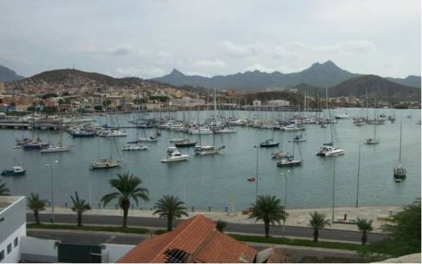
Mindelo is where most yachts go for a quick refuelling stop, but it is worth lingering longer to explore this restored colonial town. The town is situated at the edge of a subsided volcano crater, the harbour is naturally formed and is one of the most protected in the archipelago.
The town is in Porto Grande Bay (see photo courtesy of World Cruising Club), which gives total protection from NW through E to S and partial protection (with a fetch of up to 2M) from S around to W. Occasionally a westerly swell can set in which can make anchoring here, or berthing in the marina, rather uncomfortable.
Position 16°53.13'N,24°59.56'W (marina)
Clearance
See Cape Verdes Formalities for full details of clearing into and out of the country.
Yachts must fly the „Q“ flag until cleared in, after which the courtesy flag must be flown. These can be purchased from the chandlery at the marina or at „Casa das Bandeiras“ in the town.
The skipper should go ashore to see Immigration and Port Officials as soon as possible. The police building is on the other side of the harbour to the marina, 10 minutes walking distance. You have to visit two different offices. The marina office can provide a map and directions.
The captain must sign a form that absolves the Port Authority from responsibility in case of theft from the yacht. Ship's papers will be held by the Authorities whilst in the harbour. However, they will accept a laminated copy.
Passports are no longer retained but must be stamped by the Immigration Office (in the commercial port). It has been reported that Immigration can be a problem as they often close up shop to go to the airport.
Customs will issue clearance for the next port as for Praia. Yachts can clear out up to 24 hours before departure.
Last updated February 2018.
Docking
Marina Mindelo recommends yachts approaching the harbour keep to the north of the bay after passing the big rock „Ilhéu dos Pássaros“ in the middle of the channel. On entering the harbour keep a distance of approx. 100m off the commercial pier.
Cruisers have commented that a night entry here can be difficult as there are many unchartered wrecks and abandoned vessels, plus the navigation lights are impossible to distinguish from the ones on shore and those of the anchored ships in the bay. A chart plotter is practically essential. Marina Mindelo have reported that a clear landmark to spot at night is the bright white/red ferry called ARMAS moored to the end of the commercial part of the harbour. They recommend keeping it clear to port and enter the marina or anchorage area at moderate speed as many of the anchored yachts do not use anchor lights.
This harbour offers good shelter from the NW through E to S and partial protection (with a fetch of up to 2M) from S around to W. Very occasionally a westerly swell can set in and this can be a problem both at anchor and in the marina.
Anchoring
You may anchor here for free, but be aware that holding can be patchy as there are areas of volcanic gravel.
Yachts can anchor beyond the commercial port, in the northern part of the bay. Prevailing winds are from the NE (the trade winds), Force 3 to 5, and are pretty much constant. The harbour is subject to strong gusts, especially in winter, so make sure the anchor is well dug in. (The old steel motor yacht which previously provided a mooring is no longer there).
The marina allows anchored yachts to land and leave tenders there for a small daily/monthly charge. The marina has 24 hour security.
It is possible to drop off garbage outside the marina, in the small building just before you get to the street. Ask one of the marina staff to unlock it for you - there is a nominal charge. Locals may offer to dispose of garbage for a small fee, however be cautious in accepting this help as there is a problem in Mindelo with garbage being dumped out of sight, not in the proper receptacles.
It is not recommended to leave your dinghy unattended at the city beach of Mindelo (as in many other cities around the world).
Security
Exercise caution if you contract someone to look after your boat or dinghy while you are away, this is not always a guarantee for safe anchorage. Locals swim in the bay where yachts are anchored and there have been incidents of stolen dinghies at the beach or from yachts that were being looked after by local watchmen.
The only guaranteed safe place to leave a dinghy is at the designated dinghy pontoon in the marina. However, local police recommended not leaving your dingy on the pontoon or beach at night.
Whether at anchor or in the marina, it is recommended to keep your boat locked at all times. Avoid walking around at night.
Marina
Marina Mindelo opened here a few years ago. It provides slightly better shelter than the anchorage and has 24 hour security. Should a W swell set in during your stay here, be prepared with springs and rubber guards for mooring lines.
Pontoons are anchored to the seabed without fingers. Instead there are mooring buoys for tying to. The floating pontoons run roughly from NW to SE, so make sure that your berth is on the SW-side of the pontoons so will be blown off the pontoon. There is always some swell here and movement of the pontoons.
Daily rates are comparable to the Mediterranean, however long-term discounts are much more economical than in the Canary Islands and Europe.
Provisions & Water
Whilst basic provisions be found here for re-stocking, a much wider range is available in the Canary Islands.
Water is a scarce commodity here. The electricity company is also responsible for the water supply on the island. They use the desalinization process to get sweet water, meaning that every litre is produced by diesel and consequently limited, and expensive.
Last updated: July 2018
Berthing Master
Tel:+238 9990290
Harbour Master
Porto Grande, Mindelo, Sao Vicente
Tel:+238 324 414 Fax:+238 321 433
portogrande@enapor.cv
This office deals with commercial shipping and mega-yachts.
Marina Mindelo
Cais Alfandega Velha , 1191 Mindelo, S.Vicente , Cabo Verde
Tel:Reception: +238 230 0032 / +238 9387 832 (Johanna Meyer-Scheel) for Marina Management
/ +238 991 5878 (Kai Brossmann) for Boat CV (repair shop within the Marina) Fax:+238 230 0034 ,VHF Channel 72
http://www.marinamindelo.cv/english/ , reserve@marinamindelo.cv
Opening hours: Reception open every day
120 berth marina with all necessary facilities.
Charges are based on m2 but do not include water, electricity and WiFi. All new arrivals are given 100MB free WiFi at check-in (to test the quality and velocity before purchasing further data packs). Facilities include 24hr security, fuel, LPG, basic but adequate toilets and showers, floating Sailor's Bar. Limited chandlery, sailmaker. Provisions within walking distance.
Yacht Clubs
There are two yacht clubs, the old, nostalgic Clube Nautico just outside the Marina's pier (open Mon - Saturday, morning until midnight) and the floating Sailor's Bar / Restaurant inside the Marina (also available for Dinghy clients).
Boa Vista
Location
This island is flat with sand dunes and date palms. It is the most northerly of the southern group and is due south of Sal.
Be aware that this island can be poorly charted in some publications and subject to abnormal magnetic variations.
Position 16° 10'36„N, 22° 55'20“W (Sal Rei anchorage)
Clearance
Clearance is possible at Porto de Sal Rei, although it might be difficult to find the Port Office to do so.
If a crew member is leaving by air, be sure to obtain a visa several days in advance of the flight as the Immigration desk at the airport is not always manned. The skipper needs to accompany the crew to obtain the visa.
Last updated December 2017.
Docking
The port of Sal Rei is on the western side of the island.
Anchor east of the small island of Ile de Sal Rei, close to the beach to avoid the worst of the swell. The dinghy can be left at either the fishermen's quay or on the beach. This anchorage is very exposed and rolly and not safe in a southerly.
The island is full of tourists in the season.
Last updated December 2017.
Fogo
Location
A spectacular, lush island west of Santago.
Fogo, which is Portuguese for „fire“, hosts a single classic volcanic cone. At 9,281 feet high, Pico do Fogo is the second-tallest volcano in the Atlantic, after El Teide on the island of Tenerife.
The fertile soil, particularly inside the crater, is perfect for growing vines and coffee. Don't miss sampling the local wine at the winery inside the crater itself.
Position 14°55'25„N, 24°30'14“W (port N of Sao Filipe)
Clearance
Report to the Capitao do Porto in the harbour with all the necessary papers and passports. Some English is spoken and staff are friendly.
The standard 7 euro charge is payable on departure and this can be done on the Friday if leaving at the weekend.
Reported o.k. to visit here, even after checking out at Praia.
Last updated February 2018.
Docking
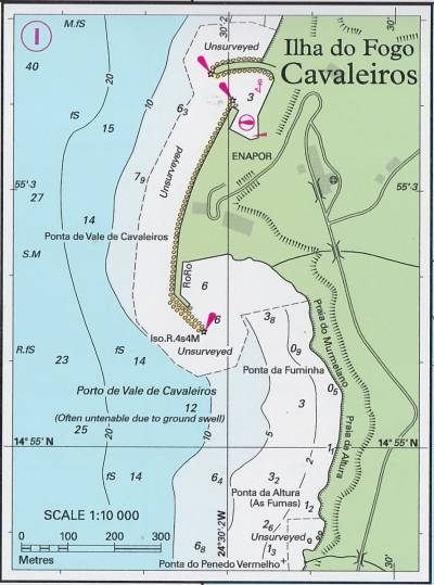
On the west coast of the island there is now a small port, Vale de Cavaleiros. It lies north of Sao Filipe. With permission, it might be possible to berth or anchor here but there is very little room and yachts are not particularly welcome.
Security: This harbour is not considered particulary safe and in 2014 robbery was still an issue.
There is also an anchorage south of the port in 4m of water, over sand, but the holding is not too good and it is wise to leave someone on board when going ashore.
Be aware that between June and November the wind may swing round to the south without warning and even local boats move out of the harbour to avoid being trapped.
Last updated February 2018.
Furna (Brava)
Location
A spectacular and beautiful island, west of Fogo. The small town of Nova Sintra is pretty and the really tiny harbour at Port de Furna is on the NE corner.
Position 14° 53'13„N, 24° 40'43“W (harbour)
Clearance
There is a Harbourmaster here, but it is permitted to visit even after clearing out at Praia.
The Harbour office is the first building on the right on entering the town. The entrace is via stairs at the back. Normal papers and passports are required. The office is not normally open at weekends, so if planning to clear out then, pay your clearing fee on the Friday.
Last updated December 2017.
Docking
It is not recommended to enter the harbour at night.
The holding is good in the sandy bottom. Yachts normally anchor to the west of the the slipway with two anchors out to the southwest, plus a stern line ashore (with anti-chafe protection) to the sea wall.
Due to the effect of the mountains on the wind, the harbour usually remains sheltered.
A possible dinghy landing is at the steps on the quay in the north part of the bay, but it is subject to some swell at high tide. There does not appear to be a problem with security here.
It is not permitted for yachts to use the ferry dock.
Last updated December 2017.
Maio
Location
This island lies to the east of Santiago. It is a low, dry island with plenty of fish, birds, turtles and deserted beaches.
Position 15° 08'20„N, 23° 13'00“W (Porto Maio anchorage)
Docking
Visiting yachts are rare here and and theft not a problem.
There is a possible anchorage at Porto de Maio on the SW side of the island.
Praia (Santiago)
Location
This is the largest of the Cape Verde islands and Praia is the capital of the country. The mountains here cause a much higher rainfall than in many of the other islands and it is, therefore, much greener with areas of rain forest. It is an island worth exploring.
Location 14° 54.23' N, 23° 30.2'W (harbour entrance)
Security Concerns
This island has a very bad reputation for theft and Noonsite has always recommended skippers organise security on board whilst anchored here. Four separate reports of armed boardings and robbery were reported from here in November 2017 (see reports adjacent). Spending the night is not recommended in this port and if a visit is absolutely necessary, visit with caution and secure your boat and valuables accordingly.
Also, beware pickpockets ashore working in teams.
Last updated January 2018.
Clearance
This is a port of entry. See Cape Verdes Formalities for full details of clearing into and out of the country.
Call the Port Authority on VHF ch 16 on approach before entering the harbour, although there may not be an answer.
Berth at the fuel pontoon and visit Immigration (Policia de Fronteira). They are based in the new passinger terminal. All passports must be presented but not all the crew need to be present.
If not already cleared into Cape Verdes, then the Policia de Fronteira will come out to visit the yacht for which a charge will be made. In this circumstance, then it is advisable for no one to leave the yacht be for their visit. They work 08:00-16:00 (Mon-Fri).
If a crew member is leaving by air, be sure to obtain their visa from the Policia de Fronteira in advance, otherwise they will not be permitted to board their flight.
Check with the Policia de Fronteira as to which authority should be visited next as this changes frequently. Ships papers are held until departure.
Be sure to visit both required offices before departure to pay the fees, retrieve ships paper and obtain a zarpe, especially important if leaving for the Caribbean.
If planning to stop at Fogo or Brava after leaving, ensure to get permission. It is not always granted.
Last updated January 2018.
Docking
There are several anchorages here, but it is reported that the water quality is very bad. The pollution is caused by a sewer opening into the river at the head of the bay. If you use a watermaker then purification is essential.
The best anchorage is west of the fishing harbour in about 5m. The holding here is good in firm sand. Some protection from the swell is provided by the beakwater.
Up to 2m of swell can appear in this harbour from the south, making the anchorage uncomfortable, or sometimes, untenable. The holding in parts of the harbour is poor.
Dinghies can be left at the fuel pontoon where, for a small fee (agreed in advance) there are various small boys who will watch it.
Liegeplätze
Die Auflistung der Liegeplätze wurde aus Street's Guide to The Cape Verde Islands entnommen. Sofern es sich um Ankerplätze handelt wird großteils nur der Name und die Position angeführt. Details und Planzeichnungen können im Guide nachgelesen werden.
Ilho do Sal
Sal ist mit seinen 216 km² eine der kleineren der Kapverdischen Inseln, liegt am nordöstlichen Rand des Archipels und ist alten (ca. 50 Mio Jahre) vulkanischen Ursprungs. Die weitgehend flache Insel mit Kalkplateaus und Dünenlandschaft wird von einigen Zeugenbergen und abgewitterten Vulkanschloten überragt. Im Norden überwiegen Lava-Felsküsten und -strände, während der Süden durch kilometerweite feinsandige helle Strände, flache Dünen und aufgelassene Salinen gekennzeichnet ist. Einzelne Oasen mit windzerzausten Dattelpalmen wie zum Beispiel Fontona dienten in der Vergangenheit dem Gartenbau und der Viehzucht. In Pedra de Lume imponiert eine perfekt kreisrunde Caldera, deren Boden unter den Meeresspiegel abgesunken ist und die industriell als Saline genutzt wurde. Heute dient sie fast ausschließlich touristischen Zwecken, denn durch die hohe Salzkonzentration in den Salinebecken ist ein „Schwimmen“ wie im Toten Meer möglich.
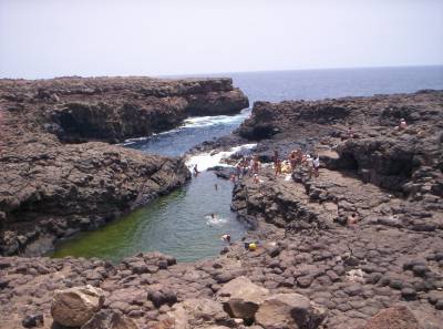
Ilha do Sal, Buracona
Sal ist ein Eldorado für Windsurfer, Taucher und Sonnenanbeter.
Baia da Palmeira
16° 45.0'N 23°01.0'W
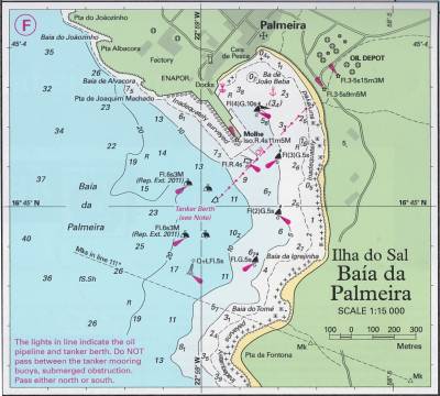
Unter normalen Bedingungen ein excellenter Ankerplatz. Bei Dünung wird es aber sehr ungemütlich.
Anlanden mit dem Beiboot ist möglich. Es gibt einige Bars und einige Einkaufsmöglichkeiten.
Es gibt auch ein kleines aber gutes Restaurant.
Baia da Mordeira
16° 41.0'N 23°00.0'W
Sehr guter Ankerplatz. Man muß sich aber vom Bereich mit Kabeln am Grund freihalten.
Santa Maria
16° 35.0'N 22°54.5'W
Baia de Pedra de Lume
16° 44.0'N 23°53.0'W
Ilha da Boavista
Boa Vista gehört zur Inselgruppe Ilhas de Barlavento (dt.: „Inseln über dem Wind“). Hauptort der Insel ist die Hafenstadt Sal Rei.
Im Inselinneren überragen einige verwitterte Vulkanschlote den Kalksockel, auf dem die ansonsten flache Insel aufsitzt. Das Inselinnere der mit 620 km² recht großen Insel ist wüstenhaft. Ausgedehnte Dattelhaine wechseln sich ab mit Dünenfeldern, gebirgiger Steinwüste und weiten Kiesfeldern in den zumeist flach auslaufenden Trockentälern. Umgeben wird die Insel von einer Kette weiter heller Sandstrände.
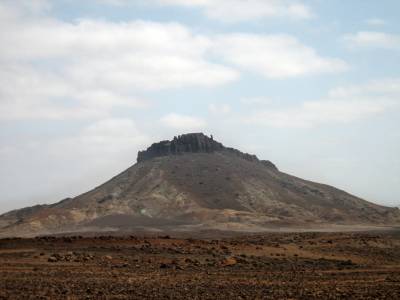
Ilha da Boavista, Pico Santo António
Strandparadies, Historische Gebäude, Kapellen und Gräber können bei Wanderungen entdeckt werden.
Porto de Sal-Rei
16° 10.5'N 23°57.0'W
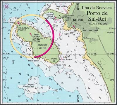
Sichere Ankerbedingungen unter normalen Wetterbedingungen.
Diesel gibt es in Kanistern im Handelshafen.
Wasser gibt es bei einem Tankwagen.
Baia do Curralinho
15° 59.3'N 22°53.7'W
Ilha de São Nicolau
Höchste Erhebung ist der Monte Gordo (1.312 m), ein jüngerer ebenmäßiger Vulkankegel mit runder Kuppe. Das gebirgige Zentrum der Insel empfängt unregelmäßig Niederschläge, während die niedrigen Küstenregionen und ausgreifenden Halbinseln wüstenartig trocken sind. Nur in Fajã kann dank eines Süßwasserstollens in nennenswertem Umfang Bewässerungs-Landwirtschaft betrieben werden.
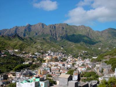
Ilha de São Nicolau, Vila da Ribeira Brava
An der Südküste gibt es eine Reihe von Buchten mit Fjordähnlichen Einschnitten, in denen man Ankern kann.
Carrical
16° 32.3'N 24° 05.2'W
Baia Gombezza
16° 32.3'N 24° 05.2'W
Bocca da Praia de Falcao
16° 35.3'N 24° 01.0'W
Baia da Chacina
16° 33.0'N 24° 07.7'W
Ponta do Ilheu
16° 33.7'N 24° 08.0'W
Aquada da Garca
16° 34.3'N 24° 09.35'W
Ponta Posson
16° 34.9'N 24° 10.3'W
Porto da Lapa
16° 35.0'N 24° 13.7'W
Preguica
Bahia de Fidalgo
16° 28.4'N 24° 19.35'W
Bahia debaixo da Rocha
16° 31.4'N 24° 20.07'W
Tarrafal
16° 34.2'N 24° 22.3'W
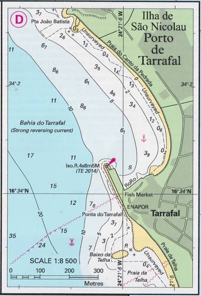
Diesel und Wasser ist erhältlich, muss aber mit Kanistern transportiert werden.
An Land gibt es Einkaufsmöglichkeiten, allerding angeblich nicht sehr gut sortiert.
Es gibt auch einige kleine Restaurants.
Ponta do Galeao
16° 40.0'N 24° 26.0'W
Ilha de Santa Luzia
Santa Luzia gehört zur nördlichen Inselgruppe Ilhas de Barlavento (dt.: „Inseln über dem Wind“).
Höchste Erhebung ist der Topona (Monte Grande) mit 397 m. Die Insel ist sehr trocken und besitzt nur eine Wasserstelle. Die den Passatwinden ausgesetzte Nordostküste ist recht rau und zerklüftet, die windabgewandte Südwestküste bildet eine langgezogene Bucht (mit Sandstrand und Dünen).
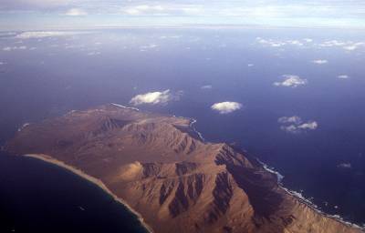
Ilha de Santa_Luzia, Luftaufnahme
16° 44.0'N 24° 46.0'W
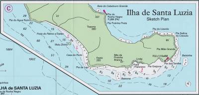
Ilheu Zinho
16° 45.12'N 24° 45.51'W
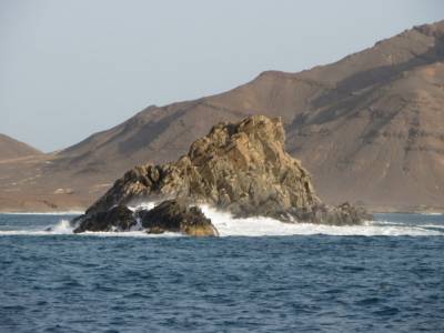
Ilheu Zinho, im Hintergrund Sana Luzia
Ankermöglichkeit zwischen Zinho und Santa Luzia.
Ilha de São Vicente
Die mittelgebirgige, trockene Insel ist jüngeren vulkanischen Ursprungs. Über weiten, mit Geröll, Kies und Sand gefüllten Tälern erheben sich drei mittelgebirgige, teils felsig-schroffe Felsmassive. Höchste Erhebung mit 750 m ist der Tafelberg des Monte Verde (port.: „grüner Berg“). Ein riesiger unterseeischer Vulkankrater im Nordwesten der Insel bildet einen der schönsten und sichersten Naturhäfen im Zentralatlantik, den Porto Grande.
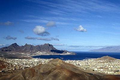
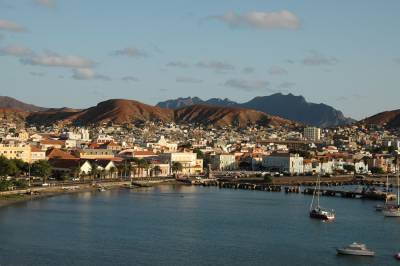
Ilha de Sao_Vicente, Blick auf Mindelo und den Monte Cara
Porto Grande/Mindelo
16° 53.2'N 24° 59.55'W
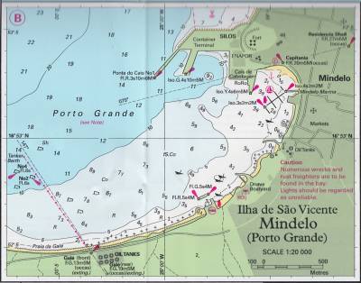
Details siehe unter Marina.
Dürfte von den Versorgungsmöglichkeiten her der beste Platz im gesamten Archipel sein.
Puerto de Sao Pedro
16° 49.0'N 25° 05.0'W
Bahia das Gatas
16° 53.0'N 24° 53.0'W
Ilha de Santo Antão
Santo Antão ist die nördlichste und westlichste Insel der Kapverden, gehört zu den Ilhas de Barlavento (dt. ,Inseln über dem Wind‘).
Die hochgebirgige Insel vulkanischen Ursprungs ist geprägt von Gebirgslandschaften mit tief eingeschnittenen Erosionstälern im Norden und nach Süden etwas flacher auslaufenden Vulkanhängen. Junge Vulkane mit weiten Caldeiras, weitläufige weißglänzende Puzzolan-Hügel und Hunderte von Metern hohe Basaltfelsen bilden dramatische Vulkanlandschaften. Auf den Höhen der östlichen Hochebene befinden sich die größten Misch- und Nadelwälder Kap Verdes. Der Nordosten der Insel ist relativ regenreich, während der Südwesten trocken bleibt. Höchste Erhebung ist der Tope de Coroa (1979 m) im wüstenartigen Westen.
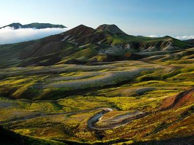
Ilha de Santo Antão, Westliche Hochebene, Tope de Coroa im Hintergrund
Porto Novo
17° 00.0'N 25° 03.5'W
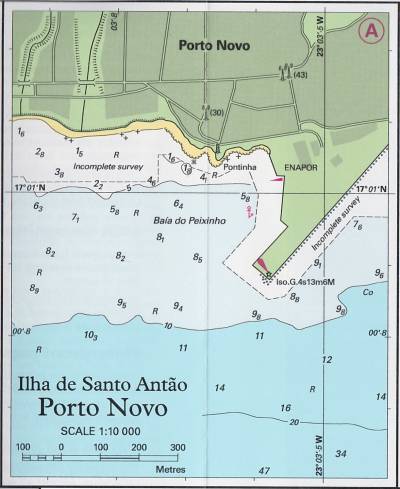
Der Ankerplatz ist etwas unsicher. Bei Landgang sollte zumindest eine Person an Bord bleiben.
Tarrafal de Monte Trigo
16° 57.3'N 25° 19.5'W
Monte Trigo
17° 00.5'N 25° 20.5'W
Ponta do Sol
17° 13.0'N 25° 06.0'W
Porto do Paul
17° 09.5'N 25° 00.0'W
Ilha de Santiago
Santiago gehört zur südlichen Inselgruppe Ilhas de Sotavento (dt.: „Inseln unter dem Wind“).
Die Insel ist vulkanischen Ursprungs mit hochgebirgigem Relief, weiten U-Tälern, Hochflächen und Zeugenbergen. Höchste Erhebung ist der Pico da Antónia (1.394 m). Das gebirgige Zentrum der Insel ist relativ regenreich und macht Santiago zur landwirtschaftlich produktivsten Insel, während die niedrigen Küstenregionen wüstenartig trocken sind.
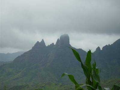
Santiago, Órgãos
Tarrafal
15° 17.0'N 23° 46.5'W
Ribeira da Barca
15° 08.8'N 23° 46.7'W
Porto Rincão
15° 03.0'N 23° 47.0'W
Ilhéu dos Alcatrazes/Bahia de Inferno
15° 01.5'N 23° 45.0'W
Porto Mossquito
14° 56.5'N 23° 42.0'W
Porto Gouvia
14° 56.5'N 23° 42.0'W
Cidade Velha
14° 54.0'N 23° 36.5'W
Calheta de São Martinho
14° 53.7'N 23° 34.2'W
Porto da Praia
14° 53.7'N 23° 30.0'W
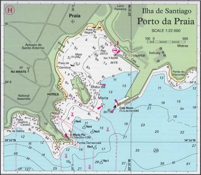
Der beste Ankerplatz für Yachten ist im NW von der Pier. Der Ankergrund ist allerding nicht gut.
Die Sicherheitslage ist leider schlecht. An Bord sollte eine Wache zurückbleiben. Auch das Beiboot kann man nicht unbeaufsichtigt lassen.
Diesel gibt es an der Tankstelle.
Die Stadt ist sehenswert.
Baia de Angra
15° 18.0'N 23° 40.5'W
Porto Formoso
15° 16.0'N 23° 40.0'W
Mangue de Sete Ribeiras
15° 15.0'N 23° 37.5'W
Cove East of Ponta da Ribeira Brava
15° 15.0'N 23° 37.0'W
Veneza
15° 12.0'N 23° 35.0'W
Calheta de São Miguel
15° 12.0'N 23° 35.0'W
Porto Coqueiro
15° 10.0'N 23° 33.0'W
Porto de Santa Cruz
15° 09.7'N 23° 32.0'W
Porto de Pedra Badejo
15° 08.4'N 23° 31.0'W
Ponta Pinha
15° 07.0'N 23° 29.0'W
Monte Negro
15° 06.0'N 23° 29.0'W
Ponta Porto
15° 04.3'N 23° 27.7'W
Ponta Salameia/Ponta Inglez
15° 03.0'N 23° 26.0'W
Praia de Moia Moia
15° 02.0'N 23° 25.8'W
Ponta Bomba
15° 00.5'N 23° 25.2'W
Porto Lobo
15° 00.0'N 23° 25.0'W
Ponta Leste & Porto de São Francisco
14° 58.2'N 23° 26.3'W
Portete Baixo
14° 57.3'N 23° 26.8'W
Ilha do Maio
Maio gehört zur Inselgruppe Ilhas de Sotavento (dt.: „Inseln unter dem Wind“).
Die von nur wenigen verwitterten Vulkanschloten überragte, auf einem Kalksockel aufsitzende Wüsteninsel hat eine Fläche von 269 km² und rund 8.400 Einwohner, was eine Bevölkerungsdichte von 31 Einwohnern pro Quadratkilometer ergibt. Höchste Erhebung ist der Monte Penoso (436 m). Hauptstadt und Hafenstadt ist Cidade do Maio.
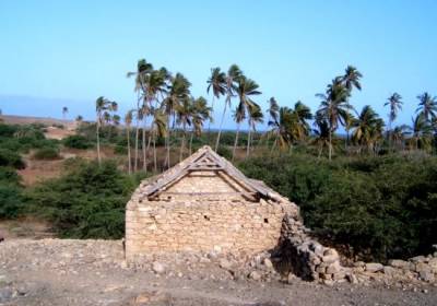
Ilha do Maio, Palmenoase bei Lagoa
Vila do Maio/Porto Inglez
15° 07.5'N 23° 14.0'W
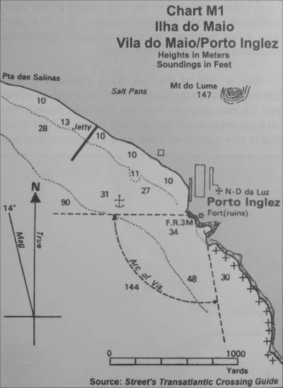
Der Ort hat eine lange Strandpromenade. Es gibt auch eine Strandbar mit angeblich kaltem Bier.
Im Ort gibt es auch einen kleinen Markt und ein Internetcafe.
Ilha do Fogo
Die Insel hat die Gestalt eines völlig ebenmäßigen Vulkankegels (Stratovulkan) mit einer riesigen Caldera, in der sich ein kleinerer Konus aufgebaut hat und heute den Gipfel Pico do Fogo (dt.: „Gipfel des Feuers“) bildet. Der Pico do Fogo ist mit einer Höhe von ca. 2.829 m über dem Meer die höchste Erhebung der Kapverdischen Inseln und deren einziger aktiver Vulkan.
Nur die Höhen und Hänge an der Nordostseite sind ganzjährig grün, während sonst wüsten- und steppenhafte Trockenregionen überwiegen.
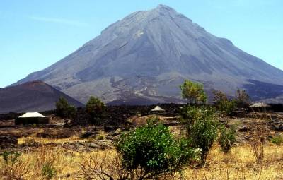
Ilha do Fogo, Pico do Fogo – Dorfhäuser in der Caldeira
São Filipe
14° 53.5'N 24° 31.0'W
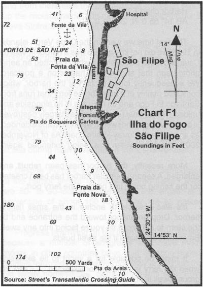
Problematische Ankerbedingungen. Falls der Anker nicht hält, ist der nächste Halt die Karibik.
Im Ort gibt es einige Versorgungsmöglichkeiten und Lokale.
Die Altstadt sollte unbedingt besichtigt werden.
Für einen Ausflug zur Caldera gibt es um 11h ein Sammeltaxi. Es wird aber empfohle, ein Fahrzeug zu mieten um zeitlich
unabhängig zu sein.
Beim anderen sehenswerten Ort auf der Insel „Mosteiros“ gibt es keinen Liegeplatz. Der wäre nur mit einem Landausflug von
São Filipe aus zu erreichen.
Vale de Cavaleiros
Ilha Brava
Brava ist nahezu kreisrund mit einem Durchmesser von bis zu 11 Kilometern und einer Fläche von 67 Quadratkilometern. Die mittelgebirgige Insel ist die westlichste der Ilhas de Sotavento (dt. ,Inseln unter dem Wind‘).
Bravas Höhe reicht kaum aus, um Niederschlag aus den Passatwolken zu erhalten. Da sie jedoch im Windschatten des Vulkankegels von Fogo liegt, ist die Insel häufig von Lee-Wolken bedeckt, sodass die Verdunstung geringer ist und die Vegetation etwas reicher.
Die Insel erhebt sich mit steil aufragenden Felsen zu einem breiten Plateau, das tief durch Erosionstäler eingeschnitten ist.

Ilha Brava, Steilküste im Norden mit „Wolkenhut“
Porto da Furna
14° 53.0'N 24° 40.0'W
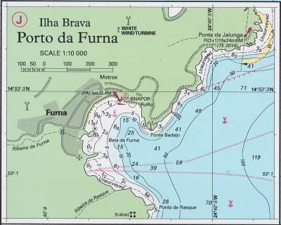
Diesel und Wasser sind nur in Kanistern erhältlich.
Es gibt im Ort eine Bäckerei sowie kleinere Geschäfte.
Fajã da Agua
14° 52.5'N 24° 45.0'W
Porto dos Ferreiros
14° 49.0'N 24° 44.0'W
Ilhéu Branco
16° 39′ 27″ N, 24° 40′ 51″ W
Das kleine Eiland gehört zur Inselgruppe der Ilhas de Barlavento (dt. luvseitigen Inseln) im Norden der Kapverden. Es liegt zwischen Santa Luzia im Nordwesten und der Ilhéu Raso im Südwesten. Nach Santa Luzia im Nordnordwesten sind es rund 8 Kilometer, zur im Südosten gelegenen Ilhéu Raso 8,5 Kilometer. Die nordwest-südöstlich ausgerichtete Insel hat eine Längserstreckung von 3,6 Kilometer und eine maximale Breite von 1,4 Kilometer. Sie erreicht eine Höhe von 327 Metern über dem Meeresspiegel.

Ilhéu Branco, Kap Verde-Schleiereule
Naturschutzgebiet. Keine Ankerplätze bekannt.
Ilhéu Raso
16° 37′ 0″ N, 24° 35′ 57″ W
Das kleine Eiland gehört zu den „Inseln über dem Wind“, portugiesisch Ilhas de Barlavento, im Norden der Kapverden. Es liegt zwischen Ilhéu Branco im Nordwesten und São Nicolau im Osten. Ilhéu Branco ist 8,5 Kilometer entfernt, nach São Nicolau sind es 15 Kilometer.
Die unbewohnte Insel ist maximal 3 Kilometer lang und 2,4 Kilometer breit. Ihre Fläche beträgt nur sieben Quadratkilometer, damit ist sie aber immer noch größer als die benachbarte Ilhéu Branco. Die Landschaft der Ilhéu Raso ist hauptsächlich flach, kleinere Erhebungen mit maximal 164 Metern Höhe finden sich nur im Norden des Eilands. Der Südwesten ist geprägt durch eine felsige, mit Gesteinsblöcken übersäte Ebene, die von ausgetrockneten Wasserläufen durchzogen wird. Die Küstenlinie wird von Klippen eingerahmt.
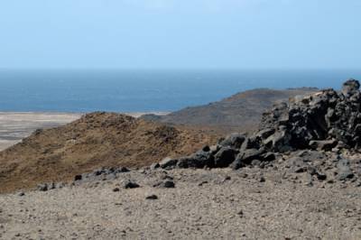
Ilhéu Raso, Die Anhöhen Rasos im Norden der Insel
Keine Ankerplätze bekannt.
Ilhéu Rabo de Junco
16° 42′ N, 23° 0′ W
Die unbewohnte Insel Ilhéu Rabo de Junco (Kapverdisches Kreol: Djeu Rób d Junk) liegt etwa 500 m westlich vom kapverdischen Sal entfernt. Das vegetationslose Eiland ist etwa 100 m lang und 100 m breit.
Ilhéu dos Pássaros
16° 54′ 34,9″ N, 25° 0′ 40,7″ W
Die Insel liegt bei 16,9097° N und 25.0113° W zwischen den kapverdischen Inseln São Vicente und Santo Antão. Von letzterer wird sie durch den Canal de São Vicente getrennt. Die Bucht von Mindelo ist eine vom Meerwasser aufgefüllte Vulkancaldera. Das Felseiland ist ein Teil des Kraterrandes der Caldera von Mindelo.
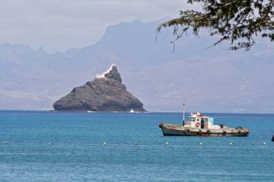
Ilhéu dos Pássaros mit Santo Antão im Hintergrund; auf der Bergspitze der Leuchtturm
Keine Anlegemöglichkeit.
Ilhéus do Rombo
14° 58′ N, 24° 41′ W
Die Inselgruppe Ilhéus do Rombo (auch Ilhéus Secos) ist Teil der Südgruppe (Ilhas de Sotavento) der Kapverdischen Inseln. Die kleine Inselgruppe liegt wenige Kilometer westlich vor Fogo und nur 6 km nordöstlich vor Brava, der kleinsten bewohnten Insel der Kapverden.
Zu den Ilhéus do Rombo zählen die beiden etwas größeren Inselchen Ilhéu Grande (3 km²) und Ilhéu de Cima (1,5 km²) sowie drei wesentlich kleinere Eilande (Ilhéu do Rei, Ilhéu Sapado, Ilhéu Luís Carneiro) mit einer Gesamtfläche von etwa 0,25 km². Hinzu kommen zahlreiche einzeln stehende Felssäulen vor und zwischen den Inseln, die insbesondere das Anlegen per Schiff erschweren. Die größeren von ihnen haben Eigennamen.
Alle Inseln der Ilhéus do Rombo sind unbewohnt und vegetationsarm. Insbesondere die beiden größten der Ilhéus weisen schöne Sandstrände auf, die gelegentlich von Badetouristen genutzt werden.
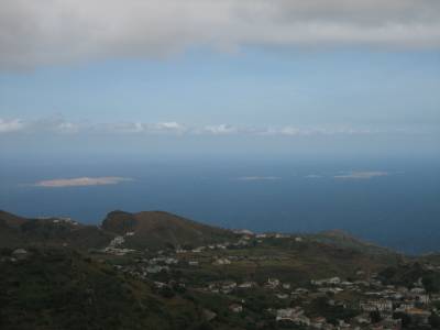
Die Ilhéus do Rombo von der Insel Brava aus gesehen mit Teilen der Stadt Vila Nova Sintra im Vordergrund.
Von links (West) nach rechts (Ost): Ilhéu Grande, Ilhéu Luís Carneiro, Ilhéu Sapado, Ilhéu do Rei und Ilhéu de Cima.
Ilhéu Laja Branca
15° 18′ 47″ N, 23° 8′ 12″ W
Die unbewohnte Insel Ilhéu Laja Branca (Kapverdisches Kreol: Idjéu Laja Branka) liegt etwa 500 m nördlich vom kapverdischen Maio entfernt. Das ehemals mit ihrer größeren Nachbarinsel verbundene vegetationslose Eiland ist etwa 400 m lang und 300 m breit.
Routenplanung
Seekarten
NV Atlas Atlantic ATL 3 2018
Imray E4 Arquipélago de Cabo Verde
Revierführer
Street's Guide to „The Cape Verde Islands“ 1st Edition 2014
Törnführer Trend Travel
Kapverdische Inseln - Aktueller Nautischer Törnführer (André Mégroz+Kai Brossmann)
(Segeln-Kapverden)
Reiseführer
Reise Know How „Cabo Verde / Kapverdische Inseln“ 9. Auflage 2018
Törnvorschlag Trend Travel
2 Wochen (ca. 322 Seemeilen)
 1: Check-in São Vicente
 2: Santo Antão (Tarrafal) 22 sm/nm
 3: Brava (Nachtfahrt) 120 sm/nm
 4: Brava Landausflug
 5: Fogo 10 sm/nm
 6: Fogo Landausflug
 7: Santiago (Tarrafal) 50 sm/nm
 8: Santiago Landausflug
 9: São Nicolau 80 sm/nm
10: São Nicolau Landausflug
11: Santa Luzia 25 sm/nm
12: São Vicente 15 sm/nm
13: São Vicente Landausflug
14: Check-out São Vicente
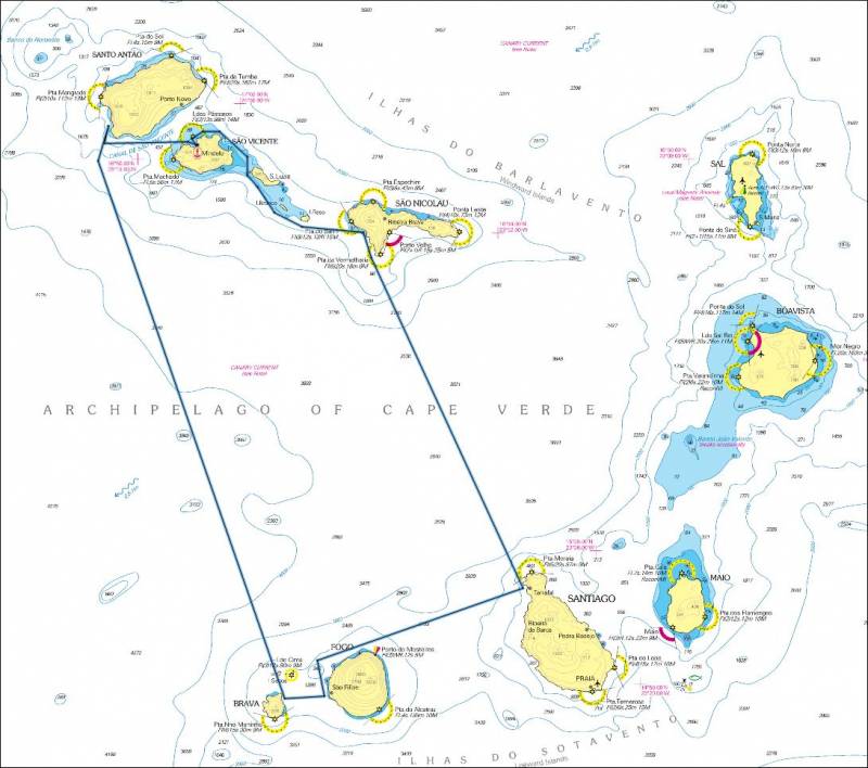
Routenplanung in der Karte
Seemeilen lt. Planung
| Ort | sm | Δ sm |
| Mindelo | 0 | |
| Tarrafal de Monte Trigo | 24 | 24 |
| Porto da Furna | 155 | 131 |
| São Filipe | 164 | 9 |
| Tarrafal de Santiago | 220 | 56 |
| Tarrafal de Nicolau | 304 | 84 |
| Santa Luzia | 330 | 26 |
| Mindelo | 354 | 24 |
Route 1
2 Wochen (ca. 489 Seemeilen)
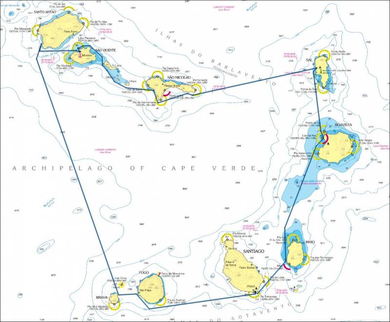
Tag 01:
São Vicente - Mindelo
- Anreise
- Schiffsübernahme
- Proviantierung
- Abendessen im Restaurant
- Übernachtung am Schiff
Tag 02:
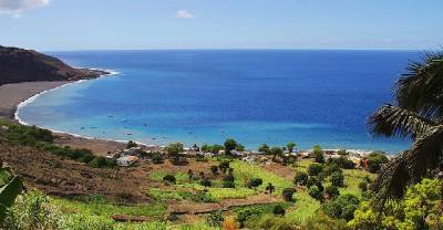
Santo Antão - Tarrafal de Monte Trigo
- Fahrt nach Ilha de Santo Antão / Tarrafal de Monte Trigo 24sm, ca. 5h
- Schiff kennenlernen und Ankern üben
- Nachtfahrt nach Brava /Porto da Furna 131sm, ca. 26h
Tag 03:
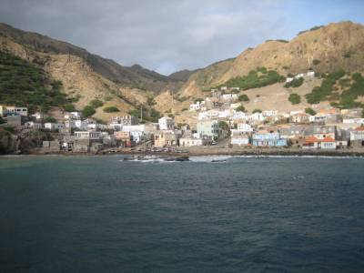
Brava - Porto da Furna
- Ankunft im Porto da Furna an frühen Nachmittag
- Landgang
- ev. Abendessen im Restaurant
- Übernachtung am Schiff
- Überfahrt nach Fogo / São Filipe 9sm, ca. 2h
- Landgang mit Besichtigung der Altstadt
- ev. Abendessen im Lokal
- Übernachtung am Schiff
- Ausflug zur Caldera des Vulkans
- am Abend Nachtfahrt nach Santiago / Porto da Praia 64sm, ca. 13h
Tag 06:
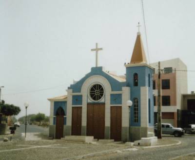
Santiago - Praia Kapelle Saint Antony
- Ankunft im Porto da Praia am Vormittag
- bei Bedarf Tanken an der Tankstelle
- Landgang mit Stadtbesichtigung und Essen im Restaurant (!Sicherheitsproblem)
- Übernachten am Schiff
- Fahrt nach Maio / Vila do Maio 23sm, ca. 5h
- Zwischenstopp mit Barbesuch
- Am Abend Nachtfahrt nach Boa Vista / Sal-Rei 65sm, ca. 13h
- Ankunft in Sal-Rei am Vormittag
- Tagesausflug Sal-Rei, ev. Restaurantbesuch
- Übernachtung am Schiff
- Fahrt nach Sal / Palmeira 36sm, ca 7h
- Landgang
- Übernachtung am Schiff
- Tagesausflug Palmeira
- Am Abend Nachtfahrt nach São Nicolau / Carrical 65sm, ca. 13h
Tag 11:
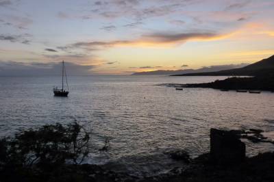
São Nicolau - Carrical
- Ankunft in Carrical am Vormittag
- Ausflug mit dem Dinghi zu einer der Seitenbuchten
- Nach Mittag Weiterfahrt nach São Nicolau / Porto de Tarrafal 22sm, ca.4h
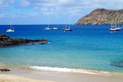
São Nicolau - Porto de Tarrafal
- Landgang
- Übernachtung am Schiff
- Fahrt nach Santa Luzia 26sm, ca. 5h
- Landausflug
- Übernachten am Schiff
Tag 13:
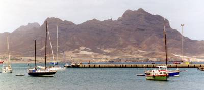
São Vicente - Blick von Mindelo auf den Monte Cara
- Fahrt nach São Vicente Mindelo 24sm, ca. 5h
- Nachmittag und Abend in Mindelo
Tag 14:
- Bis zum frühen Nachmittag Ausflug, danach Check-out
Tag 15:
- Fahrt zum Flughafen und Rückflug
Törnverlauf
Live-Tracking unserer Position
Passwort: wobistdu
Tracking
![]()
Tracking
Logbuch
Passage Plans
Sonstiges
Informationen zum Segelrevier „Cabo Verde“
AKTUALISIERT 1.Juli 2018
Einklarieren bei der Emigration
Insel Sal, Palmeira (Wüsteninsel mit All Inklusive Hotels)
Insel Santiago, Praia die Hauptstadt des Landes
Insel Sao Vicente, Mindelo (Hafenstadt mit Tradition, europäisch)
Aus dem Ausland kommend, einklarieren bei der Immigration und bei der Policia Maritim (PM).
Europäer benötigen für die Einreise kein Visum. Das erforderliche Visum wird bei der Einreise ausgestellt und gilt 3 Monate. Verlängerung vor Ort möglich, unbegrenzt und immer wieder für 3 Monate.
WICHTIG:
Wer im Land von Insel zu Insel segeln möchte, muss auf jeder Insel bei der Policia Maritim (PM) ein- und ausklarieren, Kosten z.Zt. 700,-esc (ca 6,30€) für das Ausklarieren.
Wasser und Diesel
Wasser bunkern:
Mindelo in der Marina. Auf den anderen Inseln gibt es Wasser nur in Kanistern.
Diesel bunkern:
Mindelo in der Marina.
Praia an der Tankstelle. ACHTUNG, hier nur direkt in den Tank, Kanister sind verboten. Es wird kontrolliert!
Tarrafal auf San Nicolau. Wassertiefe 2m bei Ebbe, am Fischerkai.
Diesel & Wasser in Kanistern: auf Anfrage bei Fischern oder der Bevölkerung. Überall, wo man an Land kommt, wird geholfen.
Versicherungen:
Eine Yacht-Pool Skipper-Haftpflicht-Versicherung wurde für diesen Törn abgeschlossen, die Haftungsrisiken soweit abdeckt als das irgend möglich ist.
Eine Charter-Rücktrittsversicherung wurde nicht abgeschlossen.
Jeder sollte eine private Reisekrankenversicherung haben.
Sollten noch weitere Versicherungen gewünscht sein, bitte melden.
Anbei das Angebot von Yacht-Pool.
Überblick über die Versicherungen
Online-Antragsformular
Yacht-Pool pdf Antragsformular
Kontakt
Senden eines e-Mails an den Organisator
